Siting a Pole Barn or Barndominium in Boise: Floodplains, Fire Risk, and Easements (Without Costly Surprises)

Wide-angle stock photo of a Boise-edge vacant lot with visible property boundaries, utility markers, and drainage features, highlighting considerations for building siting.

A smart site plan is as important as the floor plan

Boise-area property can be incredibly buildable—until one overlooked constraint forces a redesign, a permit delay, or a last-minute move of your building pad. If you’re planning a custom pole barn, wood-framed barndominium, shop, or stick-framed home, the best early win is doing a simple “site feasibility” pass: floodplain (water), fire exposure (wildland-urban interface), and easements (legal access/utilities).

Below is a practical, Boise-focused checklist Cascade Custom Construction uses to help clients align design with the realities of the lot—before engineering and construction documents go too far.

Important note: Requirements vary by jurisdiction (City of Boise vs. unincorporated Ada County vs. nearby cities like Meridian, Eagle, Nampa, Caldwell) and by your zoning district. Always confirm specifics with your local planning/building department and your title company survey.

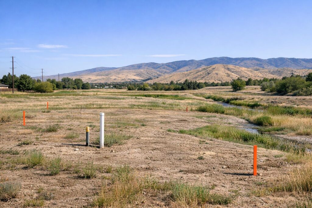
1) Floodplains: where “flat ground” can still be high risk

Floodplain constraints don’t only affect riverside property. Stormwater routes, irrigation infrastructure, historic drainage swales, and changing development upstream can all influence flood behavior. The goal isn’t to “panic about water”—it’s to place buildings so they’re easier to permit, insure, and protect long-term.

What to check early
FEMA Flood Maps: Start by checking your address on FEMA’s Map Service Center to see if you’re in a mapped Special Flood Hazard Area (often called the “100-year floodplain”). Flood risk can change as maps update.
State/Local Flood Resources: Idaho maintains floodplain mapping resources that can help you understand broader flood hazards and local administration.
Drainage on your lot: Walk the site after rain or snowmelt (or talk to neighbors) to identify where water naturally collects or moves.

If you do find floodplain involvement, it doesn’t automatically end the project. It may mean the structure’s location, elevation strategy, access, and drainage plan need to be designed with extra care—and documented in a way your local reviewer can approve.

Floodplain quick reality check
Even homes outside high-risk FEMA zones can still flood, and your risk profile can shift over time with development and weather patterns. That’s why “check the map” is step one—not the only step.

2) Fire exposure: siting and defensible space for Boise’s interface areas

In the Boise foothills and other wildland-adjacent areas, buildability isn’t only about slope and access—it’s about how fire could approach the structure and whether the site can support practical defensible space. “Defensible space” is the maintained area around a home designed to reduce wildfire intensity and give firefighters a safer working zone.

Many wildfire preparedness programs emphasize the first 0–5 feet around the structure as especially critical—often called the immediate zone—because embers and radiant heat are most punishing close to the building. Guidance commonly recommends keeping that near-home zone as noncombustible as practical and moving combustibles (like firewood) farther away.

Area
What to plan for in site layout
Common-sense examples (non-code)
0–5 ft
Keep this zone maintainable and clean; reduce ember-catch points; plan hardscape access.
Rock/gravel instead of bark mulch; avoid storing firewood right next to the building; keep debris out of corners.
5–30 ft
Create separation between fuels; ensure access for maintenance; consider how wind moves through the site.
Spacing shrubs; keeping grasses managed; choosing lower-resin landscaping near structures.
30–100+ ft
Where possible, plan a manageable buffer (more on steep slopes); create a long-term maintenance approach.
Limbing trees; breaking up continuous brush; keeping access lanes clear.
Site-design takeaway: A beautiful home on paper can become hard to defend (and hard to maintain) if it’s tucked into unmanaged fuels with no practical buffer or access. When Cascade Custom Construction helps clients choose a building footprint and driveway alignment, we’re looking for a layout that supports both aesthetics and long-term survivability.

3) Easements: the “invisible lines” that dictate where you can build

Easements are one of the biggest sources of avoidable redesign. An easement may give someone else the right to use part of your property for a specific purpose—commonly utilities, drainage, access, or shared driveways. Even if a structure technically fits on the lot, it might not be allowed where an easement exists.

What to request before finalizing your site plan
Survey or plot plan: Shows boundaries and often identifies easements.
Title report: Lists recorded easements and restrictions.
Utility locates + practical routing: Helps confirm where power, water, septic, and future service lines can realistically go.

Easements can also affect landscaping and grading. Some jurisdictions and utility corridors restrict trees or deep-rooted plantings within certain easements—something worth knowing if you’re planning privacy screening around a shop or barndominium.

Did you know? (Fast facts that impact pole barn siting)

Flood maps can change. Flood risk isn’t static—development, erosion, and updated studies can shift mapped areas over time.
The first 5 feet matters for wildfire. Many defensible-space programs prioritize the immediate zone right next to the building to reduce ember ignition.
“Looks buildable” isn’t the same as “permittable.” Setbacks, easements, and access requirements can shrink the usable building envelope more than most people expect.

Step-by-step: a practical siting checklist (Boise & Southern Idaho)

Step 1: Draw your “buildable envelope” first

Before you place a shop, pole barn, or barndominium on a sketch, outline the parts of the lot you can actually use: property lines, setbacks, septic/drainfield reserve (if applicable), and all recorded easements. This prevents the classic mistake of designing a perfect footprint that can’t be permitted where it’s shown.

Step 2: Confirm flood constraints and drainage flow

Check flood mapping, then validate with on-site observations and local requirements. If floodplain is involved, plan for documentation early so engineering and permitting don’t stall midstream.

Step 3: Plan for fire access and defensible space

Especially in foothill and interface areas, leave room for maintenance and create a layout that can be kept clean. Avoid placing buildings where steep slopes, heavy fuels, and wind exposure stack the odds against you.

Step 4: Decide how the structure will live on the property

Think through real use: turning radius for trailers/RVs, snow storage, where deliveries can stage, and where you’ll want outdoor lighting. A great site plan reduces daily friction—not just construction friction.

Step 5: Align the plan with your build type (wood framing matters)

Since Cascade Custom Construction builds wood-framed barndominiums and structures (not steel-frame barndos), your siting plan should support the right foundation approach, moisture management details, and long-term maintenance access around the exterior.

Boise local angle: what makes siting tricky in the Treasure Valley

Boise and the surrounding Treasure Valley include a mix of city lots, foothill lots, and rural parcels. That variety is great for custom builds—but it also means constraints can change dramatically within a short drive:

Foothill/interface parcels: often higher fire exposure, slope considerations, and more emphasis on access and defensible space planning.
Rural/irrigated areas: may have drainage features, canals/ditches, and utility/access easements that constrain where outbuildings can go.
Growth corridors: evolving infrastructure and updates can affect how agencies evaluate access, drainage, and future utility routing.

The best approach is to treat “siting” as a first-class phase of the project—right alongside design. When it’s done well, it protects your timeline and keeps your structure positioned for long-term durability.

Talk to a builder before your site plan locks in

If you’re in the early planning stage, Cascade Custom Construction can help you think through the siting realities that affect permitting and buildability—floodplain constraints, fire risk, easements, access, and a practical building envelope—so your design and construction plan stay aligned.

FAQ: Siting pole barns, shops, and barndominiums near Boise

How do I know if my property is in a floodplain?
Start with FEMA flood maps and then confirm with your local floodplain administrator/building department. If the site has drainage features, also assess real-world water movement on the lot.
Can I build in an easement if I “stay out of the way”?
Typically, building in easements is risky because easement holders may need access for repair or future expansion. Your title report and survey are the right starting points, followed by confirmation from the authority having jurisdiction.
What’s the biggest siting mistake you see with shops and pole barns?
Designing the building footprint first and discovering later that setbacks, easements, or access requirements shrink the usable area. Establish the buildable envelope early, then design within it.
How much space do I need for wildfire defensible space?
It depends on topography, fuels, and jurisdictional requirements. As a planning baseline, many programs emphasize strong maintenance in the immediate 0–5 feet and an expanded buffer outward where possible—especially on slopes.
Does a barndominium have different siting needs than a stick-framed home?
The siting constraints (floodplain, easements, setbacks, access) are similar, but details like driveway use, outbuilding relationships, and exterior maintenance access often matter more because many barndominium owners plan for shop space, storage, or RV access as part of daily life.

Glossary (quick definitions)

Buildable envelope: The portion of a lot where a structure can legally fit after accounting for setbacks, easements, and other constraints.
Defensible space: A maintained area around a structure intended to reduce wildfire risk and improve firefighter access.
Easement: A legal right for another party (utility, neighbor, public agency) to use part of your property for a specific purpose.
Floodplain / Special Flood Hazard Area (SFHA): Areas mapped with higher flood risk (often referenced as the “100-year floodplain”) that may carry additional building requirements.
WUI (Wildland–Urban Interface): Areas where homes and development meet or intermingle with wildfire-prone wildland vegetation.
Scroll to Top